
What is Gilgit - Baltistan known for?
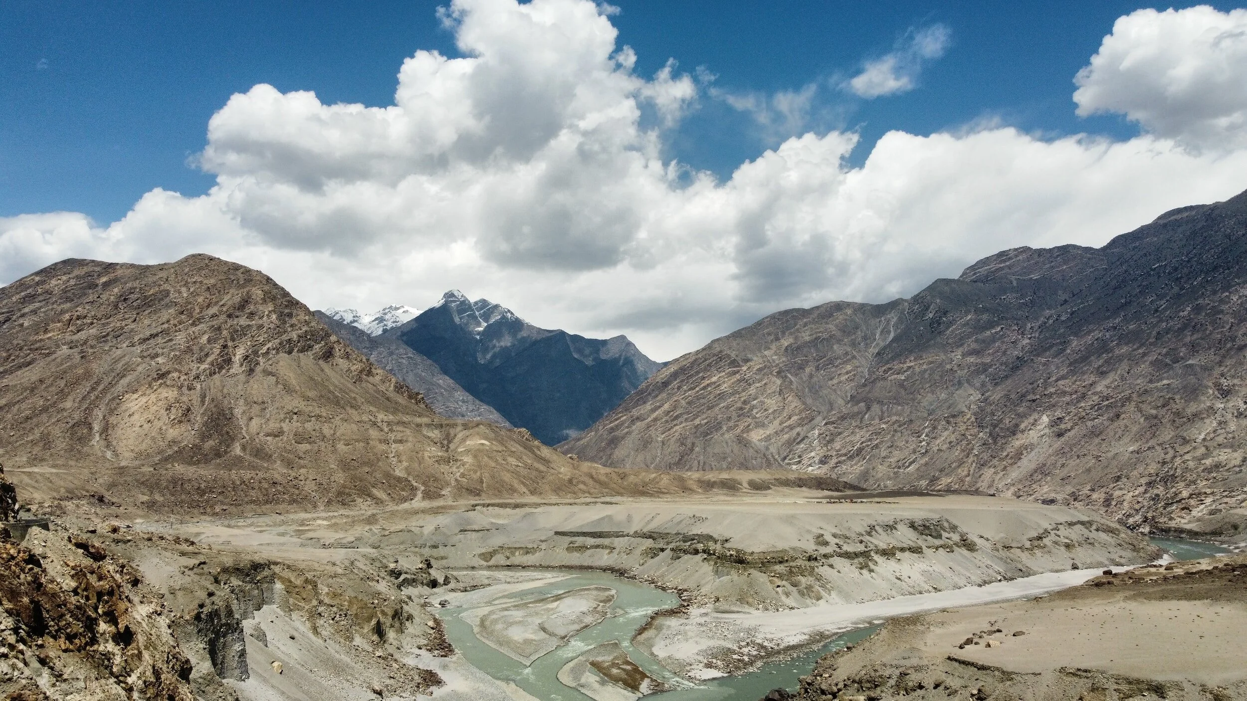
Gilgit-Baltistan is known for its stunning landscapes, majestic mountain ranges, and rich cultural heritage. Some of the world's highest peaks, including K2, the second-highest mountain globally and Attabad Lake, Its also a melting pot of cultures with diverse ethnic groups like the Balti, Shina, Burusho (Hunza), and Wakhi, each with its unique traditions, languages, and heritage

Why is the water so blue?
Many of the lakes in Gilgit - Baltistan, most notably Attabad Lake are a bright blue/turquoise color that almost seems too beautiful to be real. These lakes are glacier-fed lakes caused by a natural phenomenon in glaciers. The glaciers grind rock down into the rock flour which is then carried downstream into the lake. This rock flour then refracts the light and gives off a vivid blue or teal color.
Why is it named Gilgit - Baltistan?
Gilgit-Baltistan got its name from combining the names of two main regions, Gilgit and Baltistan. The region was previously called the "Northern Areas" but was officially renamed "Gilgit-Baltistan" in 2009 to acknowledge its distinct identity, cultural significance, and to grant it more autonomy within Pakistan.

When is the best time to visit Gilgit - Balistan?
Generally from May to October. During these months, the weather is relatively milder, and most of the tourist attractions are accessible. May to June offers pleasant temperatures, blooming landscapes, and clear skies, making it ideal for trekking and sightseeing. July to September is the peak tourist season when the weather is warmer, and most mountain passes are open, allowing for adventurous activities like trekking and mountaineering. October sees the onset of colder temperatures and the beginning of the winter season, but it's still suitable for visiting before the harsh winter sets in, especially for enjoying autumn foliage and fewer crowds.

What are the mountain ranges in Gilgit - Baltistan?
Karakoram Range: Renowned globally for hosting some of the highest peaks, including K2 (the second-highest mountain in the world), Broad Peak, Gasherbrum I and II, and Masherbrum.
Himalayas: The eastern part of Gilgit-Baltistan borders the Himalayan range, where Nanga Parbat, famously known as the "Killer Mountain," stands tall.
Hindu Kush Range: The southern parts of Gilgit-Baltistan have extensions of the Hindu Kush Range, adding to the region's diverse topography.
Pamir Mountains: The Wakhan Corridor, a narrow strip in the northeastern part of Gilgit-Baltistan, touches the Pamir Mountains, contributing to the region's natural beauty.

Is there cell/mobile service?
Yes, there is cell service in Gilgit-Baltistan, particularly in major towns and some parts of the region. However, coverage might be limited in remote or mountainous areas due to the challenging terrain. It's advisable to check with local service providers for coverage maps and be prepared for potential network fluctuations, especially in more secluded areas.

Why is Gilgit - Baltistan important for Pakistan?
Gilgit-Baltistan is crucial to Pakistan due to its strategic location, rich natural resources, significance for trade and tourism, cultural diversity, defense importance, water resources from glaciers, and historical significance, all contributing to the country's economy, security, and regional connectivity.

Do I need bear spray in Gilgit - Baltistan?
The need for bear spray in Gilgit-Baltistan depends on the specific trekking or camping areas you plan to visit. While encounters with bears are rare in most frequented areas, certain remote or higher altitude regions might have a bear presence. It's advisable to consult local guides or authorities for insights into wildlife in your chosen trekking zones and consider safety measures accordingly.

Do you need a guide in Gilgit - Baltistan?
It's recommended to have a guide in Gilgit-Baltistan for a more enriching experience, especially if exploring remote areas or seeking insights into local culture and history.
A government-required guide for trekking in Gilgit-Baltistan is typically necessary in restricted or sensitive areas to ensure security and safety. Check local regulations before planning your trek to know if a licensed guide is needed for specific routes.

Are there animals in Gilgit - Baltistan?
Gilgit-Baltistan is home to various wildlife species. Some of the notable animals found in the region include the snow leopard, brown bear, ibex, markhor (a type of wild goat), Marco Polo sheep, marmots, and different bird species. The diverse landscapes and mountains provide habitats for these animals, contributing to the region's rich biodiversity.

How cold does it get in Gilgit - Baltistan?
Gilgit-Baltistan experiences varying cold temperatures based on the season and altitude. In winter, temperatures can drop significantly, often reaching below freezing point. In higher altitude areas, especially during peak winter months from December to February, temperatures can plummet to sub-zero levels, sometimes as low as -10°C to -15°C (14°F to 5°F) or even lower. Lower-lying regions might experience less severe cold, but it's advisable to be prepared for chilly conditions, especially during the winter season.

When should you avoid visiting Gilgit - Baltistan?
It's advisable to avoid visiting Gilgit-Baltistan during the winter months, particularly from December to February, due to harsh weather conditions. The region experiences extremely cold temperatures, heavy snowfall, and limited accessibility to some areas, making travel challenging and restricting outdoor activities. Additionally, some mountain passes and trekking routes might be closed or hazardous during this period.

Are there mosquitos in Gilgit - Baltistan?
Gilgit-Baltistan generally has fewer mosquitoes compared to other regions with warmer climates. The mountainous terrain and cooler temperatures tend to reduce mosquito populations. However, in lower altitude areas or near water bodies during certain times of the year, there might be some mosquitoes. It's advisable to carry mosquito repellent if you're sensitive to insect bites or traveling to areas with standing water.

What airport is best for travelling Gilgit - Baltistan?
The closest airport for traveling to Gilgit-Baltistan is Gilgit Airport (GIL). However, flights to Gilgit Airport might be limited and subject to weather conditions, especially during certain seasons. Alternatively, many travelers use Islamabad International Airport (ISB) in Islamabad as a gateway to Gilgit-Baltistan. From Islamabad, there are regular flights to Gilgit and Skardu, the main towns in the region. Skardu Airport (KDU) is another option for travelers, especially for those planning to visit the Skardu area specifically.

How expensive is a tour of Gilgit - Baltistan?
Tour prices in Gilgit-Baltistan can vary significantly based on the duration, itinerary, services included, and the tour operator's quality. A basic guided day tour might range from $50 to $100 per person, covering transportation, guide fees, and entry to attractions. Multi-day tours with accommodations, meals, and additional activities can range from a few hundred dollars to over a thousand dollars per person, depending on the level of comfort, services, and exclusivity.
Specialized adventure tours, treks, or mountaineering expeditions with experienced guides might cost more due to logistics, equipment, and permits.

Do I need a car in Gilgit - Baltistan?
While having a car can offer convenience and flexibility, it's not a necessity for exploring the region. Public transport like local buses, shared vans, or taxis are available for inter-city travel, and trekking routes often require walking.
If you prefer more independence and want to explore remote areas at your own pace, renting a car or hiring a private driver might be beneficial, especially if you plan to visit less accessible places. However, road conditions, terrain, and navigation challenges should be considered before opting for a self-driven car. It's advisable to assess your itinerary and travel needs to determine if having a car is essential for your trip.

How many days do you need to visit Gilgit - Baltistan?
Short Trip (3-5 Days): If limited on time, focus on specific areas like Gilgit or Skardu, visiting key attractions, and enjoying shorter treks or day trips.
Standard Trip (7-10 Days): This duration allows for a more comprehensive exploration, covering multiple towns or valleys, enjoying moderate treks, and experiencing the cultural diversity of the region.
Extended Trip (More than 10 Days): For a deeper immersion into the region's beauty and culture, this duration allows for extensive exploration, longer treks, and visits to more remote areas.

What are the best photo spots in Gilgit - Baltistan?
Gilgit-Baltistan is full of picturesque spots, so keep your camera ready to capture the stunning landscapes and cultural richness of this region.
Hunza Valley: Capture stunning views of Rakaposhi and Passu Cones, especially from Eagle's Nest viewpoint and Duikar village.
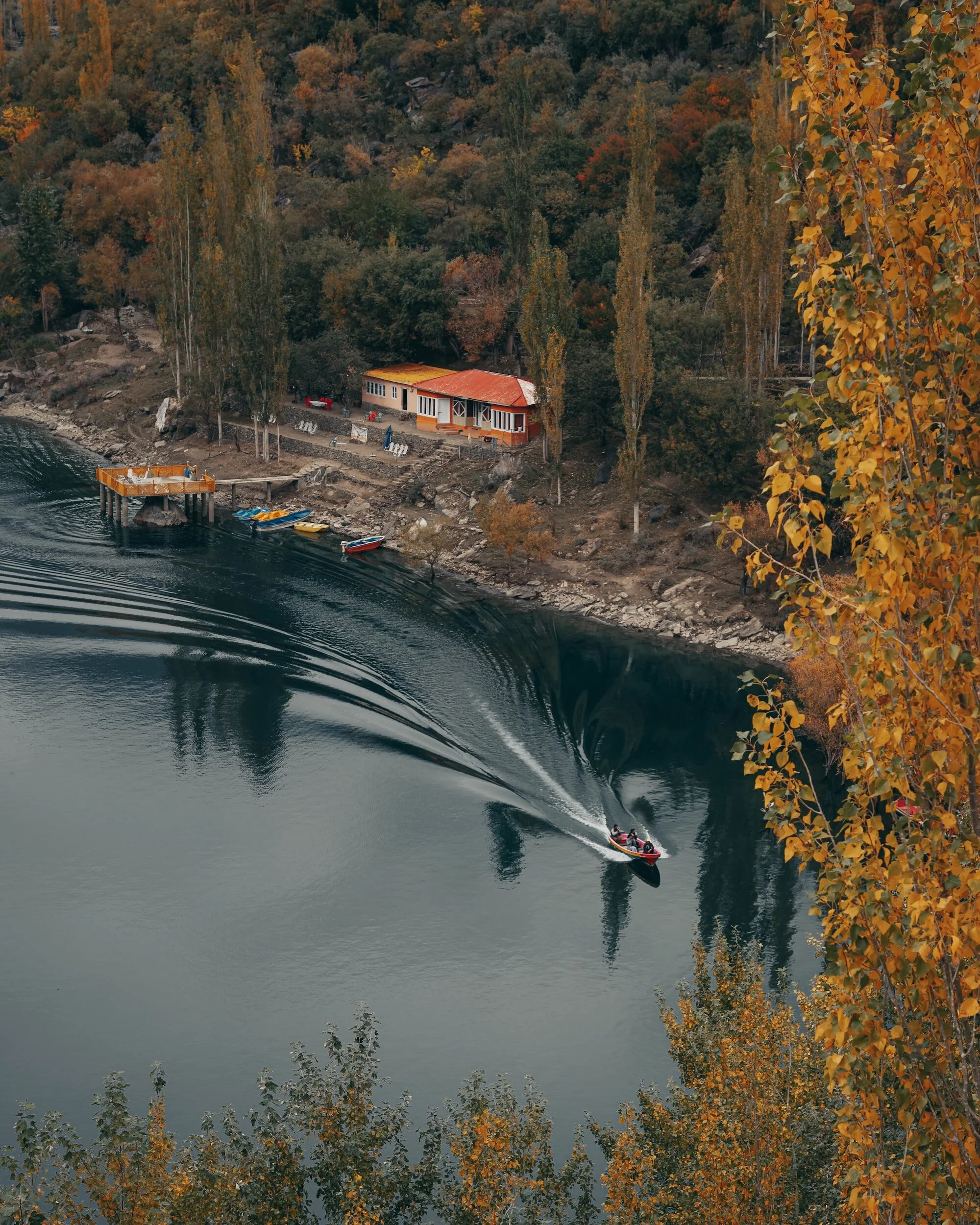
Attabad Lake: The vibrant turquoise waters against the backdrop of mountains offer spectacular photo opportunities.

Can I fly a drone in Gilgit - Baltistan?
Flying a drone in Gilgit-Baltistan is subject to regulations and permissions from local authorities and the Civil Aviation Authority of Pakistan (CAAP). While drones are increasingly popular for capturing aerial views of the stunning landscapes, certain areas might have restrictions due to security reasons, sensitive locations, or concerns for wildlife and local communities.
What are easy treks/hikes in Gilgit - Baltistan?
Rakaposhi Viewpoint Trek: Accessible from Minapin village, this moderate trek offers splendid views of Rakaposhi Peak without requiring extensive hiking.
Fairy Meadows Trek: A relatively easy hike from Raikot Bridge to Fairy Meadows presents mesmerizing views of Nanga Parbat, especially during sunrise and sunset.
Naltar Valley Lakes: Trek to Naltar Lakes, like Bashkiri and Satrangi, for scenic beauty without strenuous trekking, accessible by vehicle part of the way.
Shigar Valley Village Walks: Explore the picturesque villages of Shigar Valley on easy walks, interacting with locals and enjoying the scenic landscapes.
Upper Kachura Lake Walk: A short, pleasant walk around Upper Kachura Lake near Skardu offers serene views and is accessible to most visitors.
Phandar Valley Exploration: Explore Phandar Valley by gentle walks along the riverside, enjoying the valley's tranquil beauty and local culture.

Can you see stars in Gilgit - Baltistan?
Gilgit-Baltistan is known for its incredibly clear and unpolluted night skies, providing excellent conditions for stargazing and viewing the Milky Way. In remote areas away from light pollution, especially in valleys or high-altitude locations, the night sky often offers a spectacular view of the Milky Way galaxy. Places like Fairy Meadows, Deosai National Park, or some valleys in Hunza or Skardu offer fantastic opportunities to witness the brilliance of the Milky Way on clear nights. These locations attract astrophotographers and astronomy enthusiasts due to the clarity and vividness of the night sky.